What is UAV Payload? A Comprehensive Analysis and Application Guide
Drone Battery
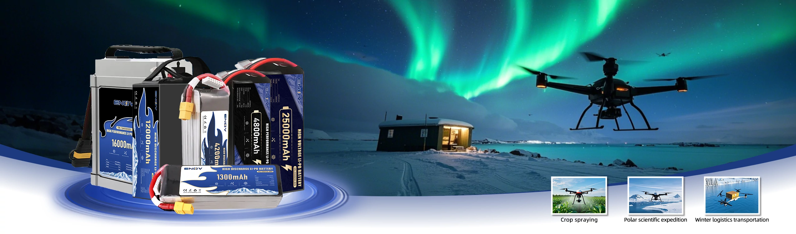
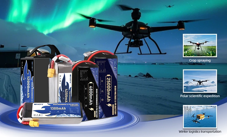
ENOV High-Energy drone batteries power industrial and commercial drones. Delivering 220–320 Wh/kg energy density, they enable long flight times (30+ mins) and support fast charging (2C). Perfect for aerial photography, surveillance, and delivery drones.
A UAV (Unmanned Aerial Vehicle) payload refers to various devices, modules, or materials specifically used to achieve specific mission objectives during the task execution of an unmanned aerial vehicle, excluding the core systems essential for ensuring its basic flight operations (such as the power system, flight control system, navigation system, and basic communication system). It serves as the “mission-execution core unit” of the UAV. A UAV without a payload can only perform flight movements, but when equipped with different payloads, it can acquire specific functions like aerial photography, surveying and mapping, material transportation, and environmental monitoring. The type and performance of the payload directly determine the UAV’s application scenarios and actual effectiveness.
I. Core Characteristics of UAV Payloads
UAV payloads cannot be randomly matched; they need to meet the dual compatibility requirements of mission needs and UAV performance. Their core characteristics can be summarized into three aspects:
1. Mission-Oriented Design: Payload selection is entirely driven by mission requirements.
The type of payload is directly determined by specific missions, and there is no such thing as a “universal payload”. For example:
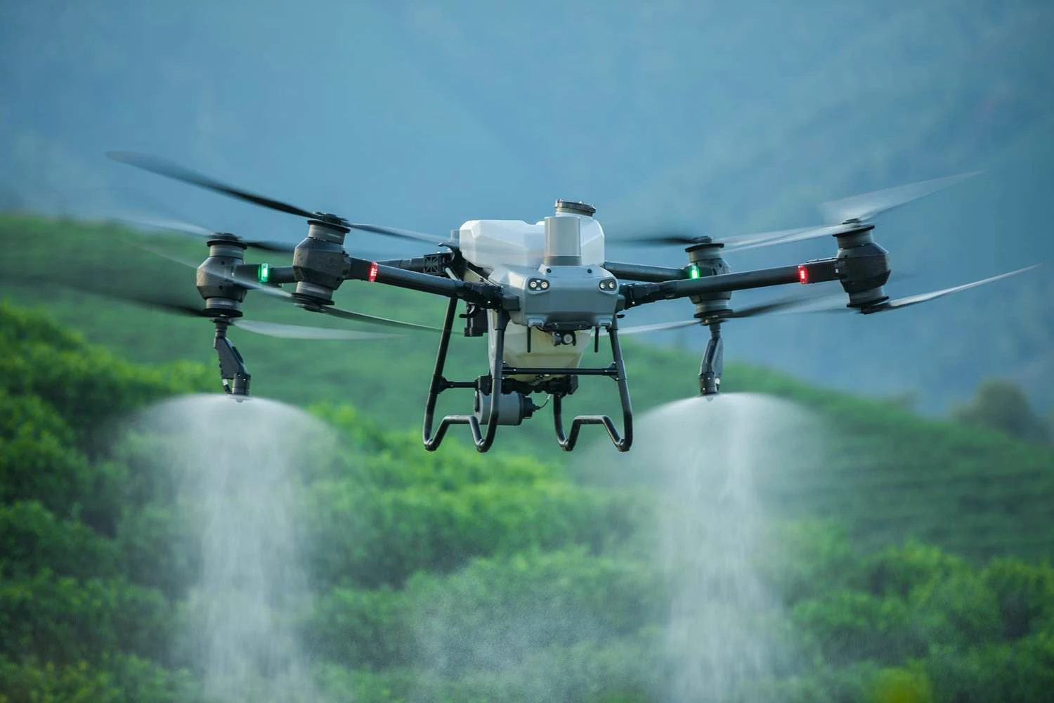
To obtain images of daytime scenes, such as landscape aerial photography and traffic monitoring, a visible – light optical camera is selected.
To locate targets at night or in complex environments (such as heavy smoke and dense forests), like searching for survivors and monitoring forest fire prevention points, an infrared thermal imager is chosen.
To detect insulation leakage in power lines and hidden damages to cultural relics, an ultraviolet camera is used.
To achieve all – weather reconnaissance or surveying and mapping, a Synthetic Aperture Radar (SAR) is adopted.
2. Compatibility Requirements: Payloads must match the UAV's performance.
The parameters of the payload must be strictly compatible with the UAV’s load-carrying capacity, power supply capacity, and installation space, among other factors, to avoid flight failures caused by “a small horse pulling a large cart.” Specifically, it includes four aspects:
Weight Matching: The UAV’s maximum take-off weight must cover the weight of the payload (including the mounting structure). For example, the payload of consumer-grade UAVs is usually less than 5kg, that of industrial-grade UAVs is about 2.7kg, and heavy-duty transport UAVs can carry several hundred kilograms.
Power Supply Matching: The payload relies on the UAV for power supply. Excessive power consumption will cause the UAV’s battery to run out quickly or result in a power outage. For example, a high-power LiDAR (Light Detection and Ranging) requires the UAV to be equipped with an additional power supply module.
Size and Installation Matching: The volume of the payload must be compatible with the UAV’s mounting space, such as the fuselage cabin, wing mounting points, and gimbal bracket. For example, a small camera can be installed via a gimbal, while large payloads, such as logistics cargo compartments and pesticide tanks, require dedicated external pods or built-in cabins, such as the transport box of the Autel Titan UAV.
Interface Matching: The payload needs to interact with the UAV’s flight control and communication systems through standardized interfaces such as USB, CAN bus, HDMI, and the DJI Payload SDK. For example, the flight control can control the camera to trigger photo-taking at regular intervals or transmit payload data back to the ground station in real-time.
3. Collaborative Workability: Payloads Need to Collaborate with Other UAV Systems
Payloads cannot complete missions independently; they need to cooperate with the UAV’s navigation and communication systems to achieve functional implementation:
In surveying and mapping scenarios, a high – precision optical camera must combine with the UAV’s differential GPS data to mark the longitude, latitude, and altitude of the captured images, enabling the generation of maps with centimeter – level accuracy.
In reconnaissance scenarios, the intelligence data from the electronic reconnaissance module needs to be transmitted back to the ground control station in real – time through the UAV’s communication link (such as 4G and satellite communication).
In agricultural plant protection scenarios, the multispectral sensor needs to interact with the UAV’s flight path planning system to adjust the pesticide dosage of the spraying system based on crop growth data.
II. Detailed Classification of UAV Payloads
Based on their functional positioning, UAV payloads can be divided into two major categories: “mission payloads” (which directly achieve mission objectives) and “support payloads” (which assist mission payloads in working efficiently). The specific subdivisions and application scenarios are as follows:
(I) Mission Payloads: Payloads That Directly Accomplish Core Missions
Mission payloads are the “core tools” of UAVs and can be divided into four major categories according to mission types:
| Major Payload Category | Specific Type | Key Applications |
|---|---|---|
|
Imaging Payloads |
Visible-light camera |
Aerial photography, film and television shooting, disaster investigation, traffic monitoring, appearance inspection of infrastructure (such as bridge cracks) |
|
Infrared thermal imager |
Night reconnaissance, heat detection of power lines, forest fire prevention (identifying high – temperature points), human search and rescue (capturing biological heat sources) |
|
|
Multispectral/hyperspectral camera |
Agricultural remote sensing (monitoring crop growth and diseases/pests), environmental monitoring (identifying water pollution and vegetation coverage) |
|
|
Ultraviolet camera |
Detection of insulation leakage in power lines, restoration of cultural relics (identifying damages to the paint layer) |
|
|
Measurement & Detection |
LiDAR |
Topographic surveying and mapping, 3D modeling (buildings, mines), collection of high – precision maps for autonomous driving, calculation of forest stock volume |
|
Synthetic Aperture Radar (SAR) |
All-weather surveying and mapping (not affected by weather), military reconnaissance (penetrating vegetation/camouflage), marine monitoring (sea waves, ships) |
|
|
Environmental sensors |
Environmental protection monitoring (toxic gas leakage from chemical plants, water pollution), meteorological monitoring (temperature, humidity, wind speed) |
|
|
Special detectors |
Archaeological exploration (searching for underground relics), mine clearance (detecting metal landmines), geological exploration (identifying underground rock formations) |
|
|
Operational & Transport |
Agricultural spraying system |
Agricultural plant protection (applying pesticides to crops), sowing/afforestation (sowing seeds and tree species), grassland reseeding (spreading fertilizers) |
|
Emergency/firefighting equipment |
Forest fire fighting, fire fighting in high-rise buildings in cities, emergency search and rescue (shouting to trapped people) |
|
|
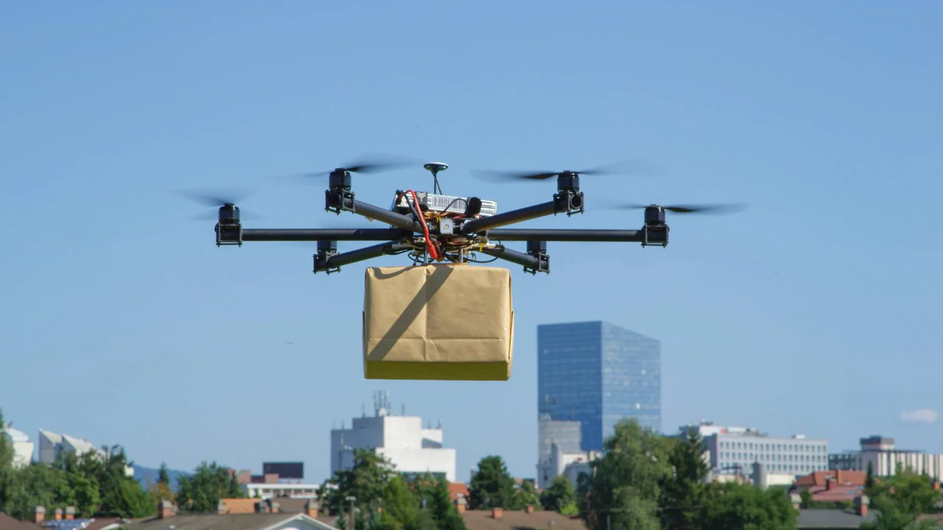
Cargo delivery pods |
Logistics distribution (small parcels), emergency rescue (delivering food, medicine, and life – saving equipment) |
|
|
Communication & Electronic |
Communication relay modules |
Signal coverage in remote areas (mountains, seas), temporary communication after disasters (base station damage after earthquakes) |
|
Electronic warfare/jamming devices |
Military electronic warfare (jamming enemy communication/radar), radio supervision (investigating illegal signals) |
|
|
Military-Specific |
Reconnaissance devices |
Military intelligence collection, battlefield situation monitoring |
|
Weapon systems |
Strike missions of military UAVs (such as the U.S. military’s “Reaper” UAV) |
(B) Support Payloads
Although support payloads do not directly complete missions, they can improve the stability and efficiency of mission payloads. They mainly include three categories:
Stabilization Platforms (such as gimbals): Offset the jitter of the UAV during flight to ensure clear images captured by imaging payloads (cameras, radars). For example, the three-axis gimbal of an aerial camera can achieve “images as stable as stillness”.
Data Storage and Processing Modules: Store the images and sensor data collected by the payload. Some high-end modules can process data in real-time, such as the surveying and mapping payload generating a Digital Surface Model (DSM) in real-time.
Additional Power Supply Modules: Such as backup batteries and solar panels, which extend the working time of high-power consumption payloads (such as LiDAR and long-term communication relay equipment) and are suitable for continuous monitoring tasks.
III. Key Technical Parameters of UAV Payloads
When selecting or evaluating a payload, the following core parameters should be focused on, as they directly determine the mission effect and compatibility:
| Parameter Category | Specific Parameters | Impact |
|---|---|---|
|
Imaging Performance Parameters |
Resolution (pixels/image size) |
The pixels of an optical camera (such as 12 million, 20 million) and the image size of an infrared thermal imager (such as 640×512). The higher the resolution, the clearer the details. |
|
Detection Capability Parameters |
Detection Range/Ranging Radius |
The ranging radius of LiDAR (such as 100 meters, 500 meters) and the detection distance of radar. The larger the range, the higher the mission coverage efficiency. |
|
Measurement Accuracy Parameters |
Positioning Accuracy/Detection Error |
The positioning accuracy of a surveying and mapping camera (centimeter – level, meter – level) and the detection error of a gas sensor (±5%). Accuracy determines the reliability of data. |
|
Physical and Power Supply Parameters |
Weight/Power Consumption |
The lighter the weight and the lower the power consumption, the wider the range of UAV models it can be adapted to (for example, a small consumer – grade UAV can carry a lightweight camera). |
|
Environmental Adaptability Parameters |
Waterproof Grade/Operating Temperature Range |
The waterproof grade (such as IP67, which can prevent short – term immersion) and the temperature range (such as – 30℃~60℃) determine the applicability of the payload in rainy days, deserts, alpine environments, etc. |
|
Compatibility Parameters |
Adaptable Interface/UAV Model |
It needs to match the UAV’s interface standards (such as DJI SDK, USB-C) or specific models (such as the dedicated payload for the Autel EVO MAX series). |
IV. Payload Configurations for Typical Applications
Different scenarios have different requirements for payloads, and efficient operations need to be achieved through the combination of “core payloads + support payloads”. The following are classic matching schemes for common scenarios:
| Scenario | Payload Types | Specific Payloadsand Functions |
|---|---|---|
|
Agriculture |
Core: Spraying system, multispectral camera |
Precise pesticide application and crop health monitoring. |
|
Support: Gimbal, path planning module |
Stable imaging and efficient coverage. |
|
|
Power Inspection |
Core: Thermal imager, optical camera, LiDAR |
Detect overheating, visible damage, and line sagging. |
|
Support: Differential GPS, real-time data transmission |
Accurate fault location and instant reporting. |
|
|
Emergency Rescue |
Core: Thermal imager, loudspeaker, cargo pod |
Locate survivors, communicate, and deliver supplies. |
|
Support: Spotlight, communication relay |
Night visibility and temporary network setup. |
|
|
Precision Mapping |
Core: High-res camera, LiDAR, differential GPS |
Capture detailed images and 3D point clouds for accurate models. |
|
Support: Data processing module |
Generate orthophotos and DEMs in real time. |
|
|
Logistics |
Core: Sealed/insulated cargo pod |
Transport parcels or medical supplies safely. |
|
Support: Precision release, obstacle avoidance |
Ensure accurate delivery and collision-free flight. |
|
|
Military |
Core: SAR, optical/IR cameras, missiles |
All-weather reconnaissance and targeted strikes. |
|
Support: Electronic warfare, satellite comms |
Disrupt enemy systems and enable long-range data relay. |
Conclusion
UAV payloads bridge the gap between “flight capability” and “mission capability,” spanning applications from civil (agriculture, logistics) to military (reconnaissance, combat) and emergency response. Advances in lightweight, intelligent, and modular technologies, coupled with evolving regulations, will further overcome limitations in weight, endurance, and precision, solidifying UAVs as versatile and efficient aerial tools for complex environments.
Quick inquiry
Drop us a line, and we’ll get back to you within 24 hours.

Ariana Yuan
Digital Operations Manager
Website Planning|Marketing Project Management for Drone Batteries|Scheduled Content Refresh|SEO Optimization
Ariana Yuan
Digital Operations Manager
Website Planning|Marketing Project Management for Drone Batteries|Scheduled Content Refresh|SEO Optimization