Analysis of the System Architecture of Logistics and Transportation UAVs
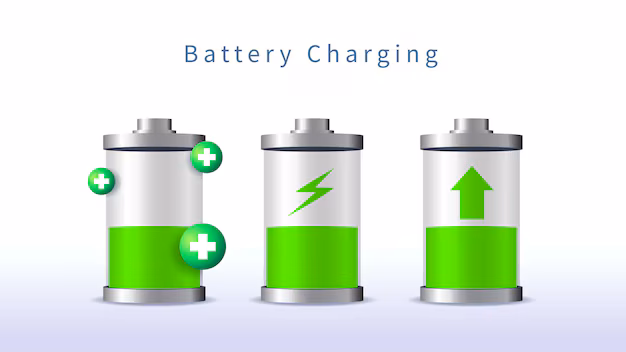
Drone Battery
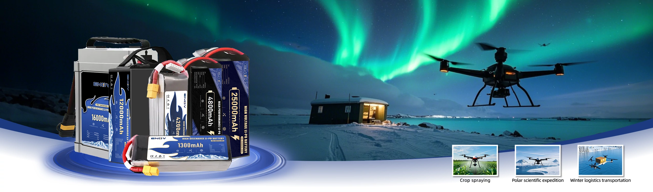
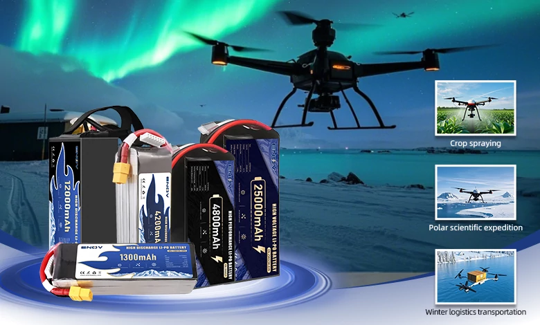
ENOV High-Energy drone batteries power industrial and commercial drones. Delivering 220–320 Wh/kg energy density, they enable long flight times (30+ mins) and support fast charging (2C). Perfect for aerial photography, surveillance, and delivery drones.
The system architecture of logistics and transportation Unmanned Aerial Vehicles (UAVs) is a complex collaborative system integrating technologies from multiple fields, such as aviation flight, intelligent control, logistics management, and communication navigation. Adhering to the “layered decoupling” design principle, it realizes the full-process automation of autonomous takeoff and landing, path planning, cargo transportation, safety monitoring, and task scheduling through efficient collaboration among various layers, ensuring the safe and efficient completion of transportation tasks. The following is a detailed analysis from aspects including core hierarchical architecture, key subsystems, typical workflow, technical challenges, and application scenarios.
1. Core Hierarchical Architecture
(1) Perception Layer: Foundation for Environmental and Status Data Collection
The perception layer, analogous to the “sensory system” of a UAV, is responsible for acquiring information about the external environment, the UAV’s own status, and the cargo status. It provides data support for subsequent decision-making and control, serving as a prerequisite for the UAV’s autonomous flight.
• External Environment Perception: Utilizing devices such as LiDAR, vision cameras (including RGB and infrared types), millimeter-wave radar, and ultrasonic sensors, it detects obstacles like trees, power lines, and buildings, identifies the location of takeoff and landing points, and judges weather conditions such as visibility and precipitation. Meanwhile, it achieves terrain recognition through binocular cameras combined with visual SLAM (Simultaneous Localization and Mapping) technology.
• Own Flight Status Perception: Relying on an Inertial Measurement Unit (IMU), gyroscope, accelerometer, barometer, and airspeed meter, it real-time acquires the UAV’s attitude data (such as pitch, roll, and yaw) as well as flight parameters (such as speed, acceleration, and angular velocity), ensuring stable and controllable flight attitude.
• Position and Navigation Perception: Equipped with GPS/Beidou positioning modules and Differential GPS (D-GPS), it provides centimeter-level or meter-level positioning accuracy, determines the UAV’s current position, and monitors the degree of route deviation to ensure precise flight paths.
• Cargo Status Perception: Weight sensors are used to monitor cargo weight and prevent overloading; pressure sensors judge the fixed state of cargo to avoid falling during transportation. For special transportation needs such as cold chain logistics, temperature and humidity sensors are employed to real-time monitor the environmental conditions of the cargo. Additionally, cargo identification can be achieved through QR code or RFID (Radio Frequency Identification) tag reading technology.
• Power Status Perception: Voltage sensors, current sensors, and fuel or electricity gauges are adopted to real-time monitor the battery power (or fuel volume for fuel-powered UAVs) and predict the endurance time. When the power or fuel level is too low, a “low-power return” warning is triggered to ensure the UAV’s safety.
(2) Control Layer: Core of Decision-Making and Flight Control
The control layer acts as the “brain center” of the UAV. Based on the data collected by the perception layer, it realizes autonomous decision-making, path planning, flight control, and abnormal handling, determining the UAV’s flight mode, route, and emergency response strategies.
• Flight Control Unit (FCU): As the core component of the control layer, it is equivalent to the “core commander” of the UAV. Through preset PID (Proportional-Integral-Derivative) control algorithms or adaptive control algorithms, it real-time adjusts the UAV’s throttle level and the angles of servos (elevator, rudder, and aileron) to achieve stable attitude control, such as resisting wind interference and maintaining flight altitude. It also accomplishes basic flight functions like precise takeoff and landing, and speed adjustment. For example, when encountering crosswinds, the FCU detects attitude deviation via the gyroscope and automatically adjusts the servo angles to counteract wind resistance and maintain route stability.
• Path Planning Module: Considering constraint conditions such as the starting point, destination, no-fly zones, real-time obstacles, and endurance limits, it dynamically generates the optimal flight path, prioritizing routes with the shortest distance, lowest energy consumption, and highest safety factor. Path planning is divided into static planning and dynamic planning: static planning pre-generates fixed routes (e.g., from the warehouse to the delivery point) before the task execution; dynamic planning, when encountering sudden obstacles like other UAVs during flight, real-time re-plans detour paths, often using algorithms such as A* and RRT* (Rapidly-exploring Random Tree Star) for path optimization.
• Abnormal Decision-Making Module: Specifically designed to handle sudden faults or risks during flight, it triggers emergency responses to ensure the safety of personnel, the UAV, and the cargo. Different decisions are made for different abnormal scenarios: in case of low power or fuel, it automatically calculates the minimum energy required to return to the starting point; if returning to the starting point is not feasible from the current position, it guides the UAV to the nearest emergency landing site; in the event of sensor failures such as GPS signal loss, it immediately switches to the “multi-sensor fusion positioning” mode (e.g., combining IMU with visual odometry for positioning), while reducing the flight altitude to shorten the landing distance; if cargo abnormalities like loose packages are detected, it triggers “emergency return” or “nearby parking” commands to prevent cargo from falling.
(3) Execution Layer: Physical Carrier for Action Execution
The execution layer serves as the “physical executor” of the control layer’s decisions. Through mechanical structures and power devices, it converts control commands into flight actions and cargo handling actions, similar to the “hands, feet, and muscles” of the UAV.
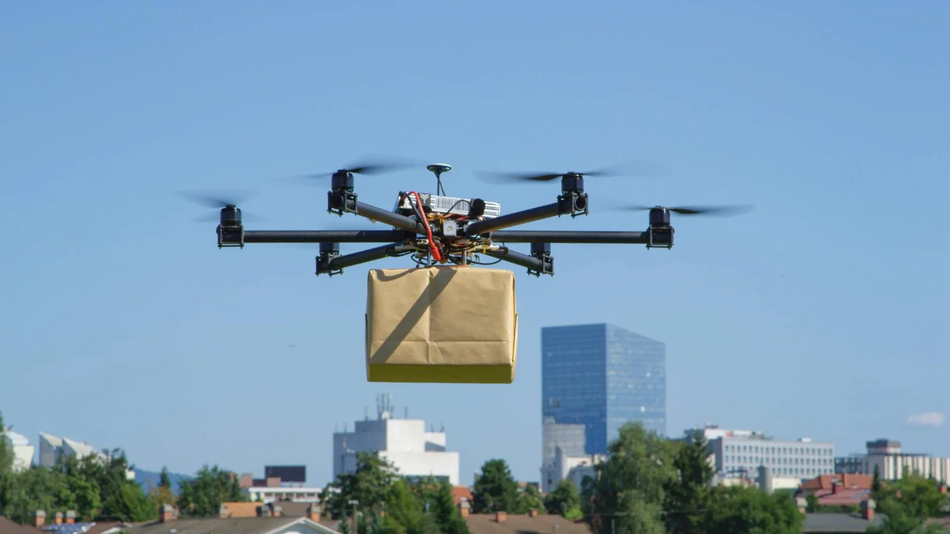
• Power Execution Unit: It provides power for the UAV’s flight, and its performance directly determines the UAV’s load capacity, endurance time, and flight speed. According to different transportation requirements, there are various types of power execution units: multi-rotor UAVs are often used for short-distance delivery, with motors driving propellers to rotate and adjusting the rotational speed of each propeller to achieve lifting and steering; fixed-wing UAVs are suitable for medium-to-long-distance trunk transportation, using engines to drive propellers or jet devices, and cooperating with wings to generate lift for long-distance cruising; Vertical Takeoff and Landing (VTOL) fixed-wing UAVs combine the advantages of multi-rotor and fixed-wing UAVs, enabling vertical takeoff and landing in narrow spaces and switching to fixed-wing mode during cruising to reduce energy consumption. There are diverse fuel options for the power system, including high-energy-density lithium batteries (e.g., 21700 cells), hydrogen fuel cells (suitable for long-endurance flights), and some heavy-duty logistics UAVs even adopt hybrid power systems combining fuel generators and electric rotors.
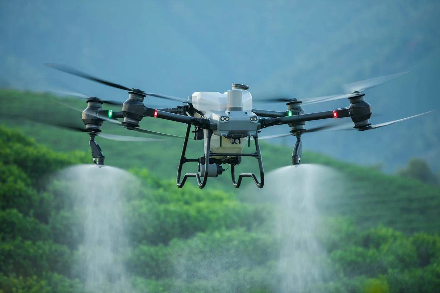
• Cargo Handling Unit: It realizes the automated operation of cargo from loading and air transportation to precise unloading, mainly consisting of two parts: the cargo compartment/cargo box and the takeoff/landing and loading/unloading mechanism. The cargo compartment/cargo box is designed according to the type of cargo, including normal-temperature cargo boxes, cold-chain cargo boxes, and waterproof cargo boxes, all equipped with automatic latches to prevent cargo from sliding during transportation; the takeoff/landing and loading/unloading mechanism is designed based on different transportation scenarios. In low-altitude delivery scenarios (e.g., end delivery to residential areas), the cargo is lowered to the ground via an “electric winch + hook” without the need for the UAV to land, or after the UAV lands, the cargo is released through an “automatically opening cargo compartment”; in trunk transportation scenarios (e.g., transfer between warehouses), it cooperates with ground automated equipment such as conveyors and robotic arms to realize the automatic docking and loading of cargo boxes. The UAV fuselage is made of lightweight materials such as carbon fiber and titanium alloy, combined with a modular design that allows for cargo compartment replacement. Meanwhile, its aerodynamic performance is optimized to reduce flight resistance.
(4) Communication Layer: Key Channel for Information Transmission
The communication layer acts as an “information bridge” connecting the UAV with the ground control center, other UAVs, and surrounding equipment. It needs to realize high-reliability, low-latency, and large-bandwidth data transmission to ensure the real-time performance of command issuance, status feedback, and emergency communication.
• Air-to-Ground Communication (Core Link): As the main communication link between the UAV and the ground control center, it mainly transmits two types of information: control commands and status data. The ground center issues task commands (such as takeoff, route change, and cargo unloading) to the UAV through this link; the UAV transmits flight data (such as position, power, and attitude), environmental data (such as obstacle information and weather), and cargo data (such as temperature, humidity, and weight) back to the ground. Different technologies are adopted based on the communication distance: for short-distance communication (within 10km), industrial-grade WiFi and LoRa (with low power consumption and strong anti-interference ability) are commonly used; for medium-to-long-distance communication (10-100km), 4G/5G cellular networks (with wide coverage and large bandwidth) or private network communications such as digital radio (with strong anti-interference ability, suitable for remote areas) are adopted; for beyond-visual-line-of-sight communication (over 100km), satellite communication technologies such as Beidou short-message and low-orbit satellites are relied on to meet the needs of cross-regional trunk transportation.
• Air-to-Air Communication (Collaborative Link): It enables direct communication between multiple UAVs, mainly used for “collision avoidance” and “task handover”. When two UAVs meet on the same route, they exchange position and speed information through air-to-air communication and automatically adjust their flight altitude or route to avoid collision. During long-distance transportation, if the preceding UAV detects abnormal weather ahead, it can real-time transmit the information to the following UAVs via this link, facilitating the following UAVs to plan detour paths. A UAV-specific Mesh network (a multi-node self-organizing network with flexible coverage) is commonly used to realize air-to-air communication.
• Emergency Communication (Backup Link): Serving as a backup channel when the main communication link is interrupted, it ensures the transmission of emergency commands, such as landing and return. Short-distance emergency communication can use Bluetooth and infrared technologies, suitable for low-altitude and short-distance scenarios; long-distance emergency communication relies on satellite communication, applicable to remote areas or high-altitude scenarios. To ensure communication reliability, the communication layer also adopts redundant designs such as dual-band communication (e.g., C-band + microwave), anti-interference technologies including AES-256 encrypted transmission and frequency hopping, and integrates with the UTM (Unmanned Traffic Management) system to ensure communication security.
(5) Scheduling Layer: Global Management and Collaborative Hub
The scheduling layer is a “global management system” beyond a single UAV. It is responsible for multi-UAV collaboration, task assignment, resource scheduling, and logistics monitoring, equivalent to the “air traffic control center + logistics management platform” for logistics transportation.
• Task Management Module: It receives logistics orders (such as cargo transportation from warehouses to delivery points), decomposes them into tasks executable by UAVs, and then assigns them to appropriate UAVs based on factors such as the UAV’s load capacity, endurance time, and current position. For example, if there are 10 orders at a delivery point, the scheduling system will match the orders based on the UAV’s “remaining power – order distance”, prioritizing the assignment of short-distance orders to UAVs with low power to improve resource utilization.
• Airspace Management Module: It plans the UAV’s flight airspace to avoid conflicts between UAVs and other UAVs or manned aircraft (such as civil aviation airliners), while keeping away from no-fly zones like airports and military areas. During peak periods such as logistics peak seasons, a dynamic airspace allocation method is adopted to assign “time slices” to multiple UAVs. For instance, UAV A is scheduled to fly on Route 1 from 10:00 to 10:10, and UAV B from 10:10 to 10:20, to prevent airspace congestion.
• Multi-UAV Collaboration Module: It realizes “relay transportation” and “swarm operation” of multiple UAVs. For long-distance orders (e.g., 500km), the relay transportation method is adopted, where multiple UAVs complete the transportation task in segments. For example, UAV A is responsible for transportation from 0 to 100km, and after transferring the cargo to UAV B, UAV B continues the transportation from 100 to 200km, and so on; when there are multiple delivery points in the same area, the swarm operation method is used, where multiple UAVs take off simultaneously and deliver goods respectively according to the “optimal path”. The scheduling system real-time monitors the position of each UAV to avoid collisions.
• Data Monitoring and Traceability Module: It real-time monitors the full-process data of logistics transportation, including flight data (such as UAV position, speed, power, and route deviation), cargo status data (such as cargo position, temperature, humidity, and whether it is damaged), and logistics data (such as delivery progress). At the same time, it records the “flight log” and “task record” of each UAV, facilitating subsequent fault diagnosis and responsibility traceability. The scheduling layer usually relies on a cloud platform, using AI technology for task assignment, real-time monitoring of the fleet status, dynamic route adjustment, and big data analysis for predictive maintenance and logistics efficiency optimization (e.g., path learning).
(6) Application Layer: Business Interface and Service Interface
The application layer is the interaction interface between the system and logistics enterprises, customers, and ground equipment. It transforms the UAV’s transportation capabilities into actual logistics services to meet the business needs of different scenarios.
• End Delivery Scenarios (e.g., communities, rural areas): It links with e-commerce platforms (such as food delivery and fresh food APPs) and community self-pickup lockers to build a complete closed-loop of “order issuance – UAV delivery – customer pickup”. Customers can check the cargo delivery progress through the APP; when the UAV arrives at the destination, customers receive a pickup code and then pick up the cargo at the self-pickup locker or designated area, solving the logistics delivery problem of the “last 100 meters”.
• Trunk Transportation Scenarios (e.g., between warehouses, between ports): It links with logistics management systems (WMS), conveyors, robotic arms, and other warehouse automation equipment to realize an automated process of “automatic cargo outbound – UAV loading – transportation – automatic cargo inbound”. After the warehouse WMS issues an “outbound command”, the robotic arm loads the cargo into the UAV’s cargo compartment; after the UAV completes the transportation task, the robotic arm in another warehouse automatically unloads the cargo and stores it in the warehouse, improving the efficiency of trunk transportation.
• Special Scenarios (e.g., emergency rescue, remote areas): In emergency rescue scenarios, it connects with the emergency command system to quickly transport medical supplies such as medicines, blood, and food, prioritizing the guarantee of “time-sensitive” tasks to gain time for rescue work; in remote area scenarios, it links with local logistics stations to solve the problem of daily necessities delivery in areas such as mountainous regions and islands, filling the logistics gap.
2. Key Subsystems
(1) Energy and Power Subsystem
• Power System: According to the UAV type and transportation requirements, electric, fuel, or hybrid power systems are selected. Electric systems commonly use high-energy-density lithium batteries and hydrogen fuel cells; fuel systems are suitable for some UAVs with long endurance and large load capacity; hybrid power systems (fuel generators + electric rotors) are mostly used for heavy-duty logistics UAVs, which can balance power performance and endurance.
• Energy Management: A Battery Management System (BMS) is equipped to realize dynamic power consumption adjustment and battery health monitoring, extending the battery’s service life. Meanwhile, it supports wireless charging and fast-charging technologies, and some systems also explore the use of renewable energy sources such as solar energy and wind energy to supplement power, reducing operating costs.
(2) Safety and Redundancy Subsystem
• Fault Tolerance: A dual-redundancy flight control design is adopted. When the main flight control system fails, the backup flight control system can take over immediately to ensure flight safety. At the same time, an emergency landing system (such as a parachute and landing algorithm) is equipped to ensure the UAV lands smoothly in emergencies.
• Network Security: Technologies such as blockchain identity authentication are used to prevent hacker attacks, and data encryption and data tampering prevention measures are adopted to ensure the security of communication data and system information.
• Airspace Security: It integrates electronic fence and intrusion detection functions to real-time monitor the airspace situation. When the UAV approaches a no-fly zone or faces an intrusion risk, an abnormal alarm is triggered, and corresponding measures (such as route adjustment and emergency return) are automatically taken.
3. Typical Workflow
• Task Initiation: The application layer receives logistics orders submitted by logistics enterprises or customers and transmits the order information to the scheduling layer.
• Task Assignment: The scheduling layer decomposes the orders, and based on the UAV’s load capacity, endurance, current position, and other factors, assigns the orders to appropriate UAVs, and issues task commands (such as “start point – end point” and “cargo information”) to the UAVs through the communication layer.
• Autonomous Flight: After the UAV is activated, the perception layer real-time collects data such as position, obstacles, and power, and transmits the data back to the control layer through the communication layer; the control layer plans the flight path and adjusts the flight attitude based on this data, and issues commands (such as “lift, steering”) to the execution layer; the execution layer realizes flight through the power device and ensures cargo safety with the help of the cargo compartment mechanism.
• Real-Time Monitoring: The communication layer continuously transmits the UAV’s “flight status + cargo status” to the scheduling layer. The scheduling layer real-time monitors the transportation process; if abnormal situations (such as the UAV deviating from the route or abnormal cargo status) are detected, emergency commands are immediately triggered and transmitted to the UAV through the communication layer.
• Task Completion: After the UAV arrives at the destination, the execution layer completes the cargo unloading operation; the application layer updates the order status in a timely manner and notifies the customer to pick up the cargo; the UAV returns to the hangar according to the command for charging and maintenance, preparing for the next task.
4. Technical Challenges
• Regulatory Compliance: UAV logistics transportation involves regulatory issues such as airworthiness certification and airspace integration. For instance, obtaining FAA Part 135 certification requires compliance with different regulatory requirements of various countries or regions. The imperfections and variations in regulations pose challenges to the large-scale application of UAV logistics.
• Extreme Environment Adaptability: Under extreme environments like strong winds, rain, and snow, high temperatures, and low temperatures, the performance of UAV sensors, the stability of power systems, and communication quality are affected. How to ensure the safe and stable operation of UAVs in extreme environments is a crucial technical challenge currently faced.
• Cost Balance: Core components such as high-precision sensors (e.g., LiDAR) and high-performance power systems are relatively expensive. Achieving a balance between economy and reliability—while ensuring high system reliability, reducing hardware, software, and operational costs—is the key to promoting the popularization of UAV logistics.
5. System Advantages
Compared with traditional logistics, the logistics and transportation UAV system has significant advantages: it is not restricted by factors such as terrain and traffic congestion, with delivery efficiency improved by over 50%; it can cover remote areas like mountainous regions and islands, filling logistics gaps; it does not require a large number of human resources or infrastructure investments such as roads and warehouses, reducing operational costs by 30%-40%; most of them adopt electric power systems, achieving zero emissions, being environmentally friendly, and conforming to the requirements of sustainable development.
Quick inquiry
Drop us a line, and we’ll get back to you within 24 hours.

Ariana Yuan
Digital Operations Manager
Website Planning|Marketing Project Management for Drone Batteries|Scheduled Content Refresh|SEO Optimization
Ariana Yuan
Digital Operations Manager
Website Planning|Marketing Project Management for Drone Batteries|Scheduled Content Refresh|SEO Optimization